Severe Weather Possible In Acadiana Today
Mother Nature is not being kind to Acadiana today. In addition to a threat of strong to severe thunderstorms, the area will also be under another heat advisory. The heat advisory covers the southwest portion of the state from the Atchafalaya Basin westward into Texas.
During the heat of the day, we could see heat indices ranging from 104 to 108 degrees. The most likely time for readings like that to occur is between 10 am and 4 pm. Oh yeah, we also have a severe weather threat to deal with too.
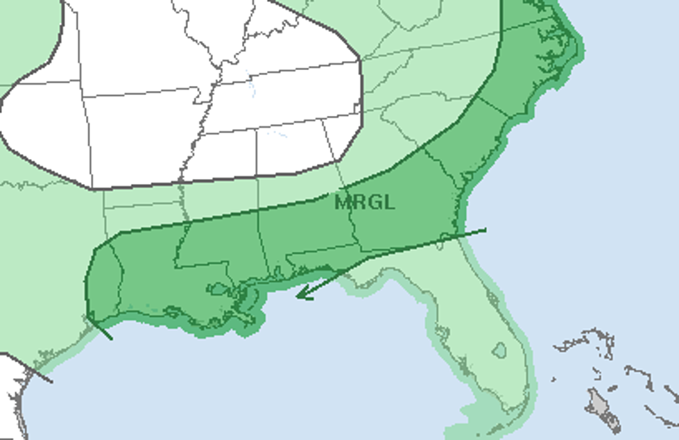
The Storm Prediction Center has placed all but the areas north of I-20 in Louisiana in the marginal risk category for severe storms to break out. Marginal risk means there's about a minimal chance of a thunderstorm reaching severe limits but there could be storms approaching severe intensity over the forecast period.
A cold front is expected to slowly sink southward across the state during the day today. This front should create enough instability in the atmosphere and provide enough lift for the moisture-laden air to expunge itself of water in the form of tropical downpours late this morning and into the afternoon.
Forecasters say there will be a significant threat of showers and thunderstorms extending into the evening hours tonight. The good news is that the cold front is expected to push through Acadiana into the Gulf of Mexico during the night time hours. That should give us less humid conditions and slightly cooler, it's still gonna be hot, temperatures for Thursday.
More From Talk Radio 960 AM