Tropical Threat Shifts East Of Acadiana
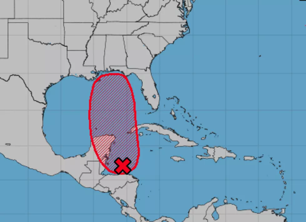
An area of disturbed weather that forecasters have been watching in the Western Caribbean Sea appears to now be on a track that would carry it to the east of Acadiana. The official track guidance from the National Hurricane Center does suggest that southeastern Louisiana, coastal Mississippi, and Alabama, and maybe the Florida panhandle could be most affected by the system.
Conditions around the broad area of circulation have become more favorable for tropical development over the past 24 to 48 hours. So, the Hurricane Center has upped the probability of the system growing into at least a tropical depression to 90% over the next five days.
Should the system strengthen to tropical storm status it would earn the name Michael. As of now, there is some uncertainty as to whether or not the system will reach that status but conditions will be conducive for some strengthening once the system moves over the warm waters of the central Gulf of Mexico.
Should this forecast track hold and this weather system be pulled off to our east that should mean some good weather for Acadiana heading into next weekend. In fact, for UL Homecoming festivities and Festivals Acadiens et Creoles at Girard Park, we could be enjoying our first taste of fall across the region.
Regardless, this system still needs to be monitored and we will do that. Just check back with us from time to time this weekend in case there are any changes that you need to be aware of.
More From Talk Radio 960 AM

![Huge Alligator Shows Up at Breaux Bridge Residence’s Doorstep [Must See Photos]](http://townsquare.media/site/33/files/2018/10/Huge-Alligator.jpg?w=980&q=75)


![Louisiana Lands High On List Of ‘Most Stressed Out States’ [Photo]](http://townsquare.media/site/33/files/2018/04/RS5412_200212196001.jpg?w=980&q=75)